Explore Pokemon
Latest about Pokemon
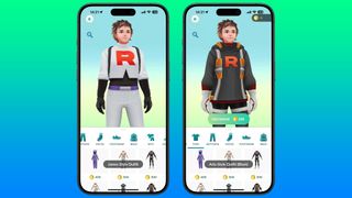
How to buy and equip a Team Rocket costume in Pokémon GO
By Daryl Baxter published
If you've got a soft spot for Team Rocket, you can show your appreciation by wearing a few outfits, for a price.

Pokémon Go: How to evolve Feebas and Wurmple quickly and easily
By Daryl Baxter, Rene Ritchie published
Having trouble trying to get Feebas and Wurmple to evolve? Here's how!

Pokémon Go: All the Regional Exclusives and where to find them
By Daryl Baxter, Rene Ritchie published
You'll need to go all around the world to find regional exclusive Pokémon in Pokémon Go!

Pokémon Go Buddy: How to choose your next best friend
By Rene Ritchie, Serenity Caldwell, Daryl Baxter last updated
Our guide will help you decide on the best Pokémon to choose as a buddy for your travels.

Pokémon Go Gyms: How to defend, attack, earn coins, get stardust and more
By Daryl Baxter, Rene Ritchie last updated
How do you defend Pokémon Go Gyms and attack them? Find out how to get PokéCoins, Stardust, Candy, and more!

Pokémon Go: How to beat Team GO Rocket in order to earn some big rewards
By Casian Holly, Daryl Baxter last updated
Team GO Rocket blasted onto Pokémon Go way back in 2019, but they're still around! Here's how to beat them.

Pokémon Go: The Best Movesets to Change with TMs
By Rene Ritchie, Daryl Baxter last updated
A high-level Pokémon is nothing without a few good moves. Our guide will show you the best TMs to use!

The best Pokémon in Pokémon Go
By James Bentley published
If you’re looking to take on a particularly tough gym, or want to finally finish that raid, here are the best Pokémon in Pokémon Go.

Pokémon Go level requirements: How to level up past level 40
By James Bentley published
Pokémon Go level requirements can be a bit long to meet if you aren’t prepared. Here’s all of them past level 40.

Pokémon Go: How to obtain and use Evolution Stones, as well as other special case evolutions
By Casian Holly, Daryl Baxter last updated
Some Pokémon need more than just candy to evolve. Here's everything you need to know about Evolution items!

How to get and use Metal Coat in Pokémon Go
By James Bentley published
Metal Coat in Pokémon Go is a pretty great evolutionary item that may take you a while to get. Here’s how.

How to get maximum Stardust fast in Pokémon GO
By Rene Ritchie, Daryl Baxter last updated
If you want to collect as much Stardust as possible to help train up your Pokémon, here's how to do it.

Pokémon GO: Best Movesets in 2025 so far
By Casian Holly, Daryl Baxter last updated
As new Pokémon are brought out almost every year with new movesets, we've compiled this guide to help you keep track.

How to get and use Dragon Scale in Pokémon Go
By James Bentley published
The Dragon Scale in Pokémon Go is necessary to get yourself a Kingdra. Here’s how to find and use them.

How to get and use Upgrade in Pokémon Go
By James Bentley published
If you’re looking to get Upgrade in Pokémon Go to upgrade your Porygon, here’s everything you should know.

Pokémon GO: The complete list of Shiny Pokémon you can catch in 2025
By Casian Holly last updated
Shiny Pokémon are a rare breed, especially in Pokémon GO. Our list will help you track them down!
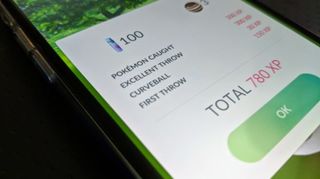
How to nail an Excellent Throw in Pokémon GO so you can evolve Farfetch'd into Sirfetch'd
By Casian Holly last updated
Here are a few things you can do to make ten Excellent Throws to evolve Farfetch'd into Sirfetch'd!

How to get Unova Stone in Pokémon Go
By James Bentley published
Unova Stone is a mysterious item that can evolve some Pokémon in Pokémon Go. Here’s how to get them and which Pokémon they evolve.
iMore offers spot-on advice and guidance from our team of experts, with decades of Apple device experience to lean on. Learn more with iMore!
